MSIS Student Charlie Mix is Putting Conservation on the Map
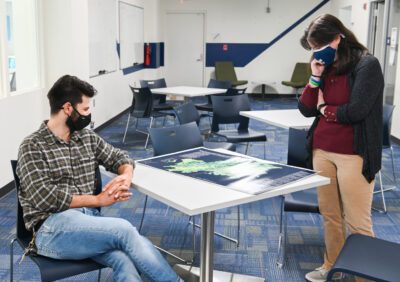
Charlie Mix and Nyssa Hunt look at the “Cradle of Southern Appalachia” map. – Photo by Angela Foster, University of Tennessee, Chattanooga Information is delivered in many forms, and for MSIS student Charlie Mix, maps are his deliverable of choice. Mix earned a bachelor’s degree in geography and went on to work for the National […]


 She was a voracious reader at a very young age – reading before talking, and consuming chapter books by the time she was four years old, she said. It was only natural that she would later end up working for a library system and getting her degree in information sciences.